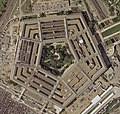
চিত্র:Pentagon satellite image.jpg

এই প্রাকদর্শনের আকার: ৬৩২ × ৬০০ পিক্সেল। অন্যান্য আকারসমূহ: ২৫৩ × ২৪০ পিক্সেল | ৫০৬ × ৪৮০ পিক্সেল | ৮০৯ × ৭৬৮ পিক্সেল | ১,০৭৯ × ১,০২৪ পিক্সেল | ২,২৬১ × ২,১৪৬ পিক্সেল।
মূল ফাইল (২,২৬১ × ২,১৪৬ পিক্সেল, ফাইলের আকার: ৪.০২ মেগাবাইট, এমআইএমই ধরন: image/jpeg)
ফাইলের ইতিহাস
যেকোনো তারিখ/সময়ে ক্লিক করে দেখুন ফাইলটি তখন কী অবস্থায় ছিল।
| তারিখ/সময় | সংক্ষেপচিত্র | মাত্রা | ব্যবহারকারী | মন্তব্য | |
|---|---|---|---|---|---|
| বর্তমান | ১৭:০৮, ১৮ অক্টোবর ২০২২ |  | ২,২৬১ × ২,১৪৬ (৪.০২ মেগাবাইট) | Cryptic-waveform | File:Pentagon-USGS-highres.jpg cropped 29 % horizontally, 39 % vertically using CropTool with precise mode. |
| ১৭:৪০, ১৩ জুন ২০০৫ |  | ৫৬৫ × ৫৩৬ (১০৮ কিলোবাইট) | Neutrality | U.S. Geological Survey satellite image of the Pentagon, taken April 26, 2002. The reconstruction of the section damaged in the September 11 terrorist attacks is visible on the building's west (l |
ফাইলের ব্যবহার
নিম্নলিখিত 2টি পাতা এই ফাইল ব্যবহার করে:
ফাইলের বৈশ্বিক ব্যবহার
নিচের অন্যান্য উইকিগুলো এই ফাইলটি ব্যবহার করে:
- ar.wikipedia.org-এ ব্যবহার
- bh.wikipedia.org-এ ব্যবহার
- da.wikipedia.org-এ ব্যবহার
- de.wikipedia.org-এ ব্যবহার
- en.wikipedia.org-এ ব্যবহার
- en.wikibooks.org-এ ব্যবহার
- en.wikinews.org-এ ব্যবহার
- en.wikiquote.org-এ ব্যবহার
- eo.wikipedia.org-এ ব্যবহার
- fi.wikinews.org-এ ব্যবহার
- fr.wikipedia.org-এ ব্যবহার
- fr.wiktionary.org-এ ব্যবহার
- he.wikipedia.org-এ ব্যবহার
- hy.wikibooks.org-এ ব্যবহার
- id.wikibooks.org-এ ব্যবহার
- it.wikipedia.org-এ ব্যবহার
- it.wikiquote.org-এ ব্যবহার
- min.wikipedia.org-এ ব্যবহার
- ms.wikipedia.org-এ ব্যবহার
- nn.wikipedia.org-এ ব্যবহার
- ru.wikinews.org-এ ব্যবহার
- scn.wikipedia.org-এ ব্যবহার
- tl.wikiquote.org-এ ব্যবহার
- uz.wikipedia.org-এ ব্যবহার
- vi.wikipedia.org-এ ব্যবহার
- vi.wikibooks.org-এ ব্যবহার
- zh.wikipedia.org-এ ব্যবহার
- zh.wikinews.org-এ ব্যবহার


